Description
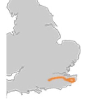
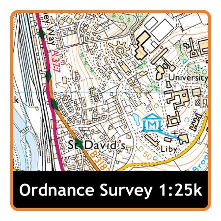
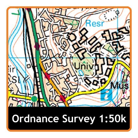
The North Downs Way follows the line of chalk hills that run through the Surrey Hills and the Kent Downs, both designated as Areas of Outstanding Natural Beauty. Much of the way is covered with woodland and rare chalk grasslands that encourage many rare and unusual species of flora and fauna. It is a route steeped in history, being the trail of pilgrimages both to Winchester and Canterbury, and is as rewarding today as it has always been.Our which resolution link is our helpful guide on which map resolution is right for you.ÿLength of path 253km/156miles. This map card contains: Topographical Ordnance Survey (OS) 1:25,000 Explorer of National Trail Topographical Ordnance Survey (OS) 1:50,000 Landranger of National Trail
This SD MapCard is designed to work with the Satmap Active range of GPS sports mapping devices. The latest Active 12 is a large screen Sports Mapping GPS, which displays highly detailed topographic mapping. Whilst being easy to use for new users, it also has a host of advanced features valued by professionals.
The Active 12 follows on from the award winning Active 10 range, but includes a range of exciting new features:
NEW: Large, bright 3.5″ Hi-Res screen (HVGA, twice the pixels of the Active 10)
NEW: Bluetooth Smart (4.0) – for route sharing between Active 12 units.
NEW: Bluetooth Smart (4.0) – for Heart Rate Monitor and bike Speed/Cadence sensor support.
NEW: Barometric Altimeter, for accurate pressure and elevation data
Active 12 GPS units come with 1 year free access to Satmap Xpedition Premium (online mapping and planning tool).
The Active 12 device is pre-loaded with the following mapping:
- GB 1:250,000 & 1:1 million OS road mapping
SD card mapping – Plug and Play
No Computer needed, Personalise routes, using multi-media, and audio visual POI’ bringing your routes to life
Real, high quality maps supported by Ordnance Survey
Download or share your favourite routes via a simple USB cable
Annotated and automatic trip statistics recorded whilst on route
Powerful pan and Zoom, enlarge up to 5 times, zoom out for larger map area
Visual route planning
Each map gives 1:25k EXPLORER and 1:50k LANDRANGER
17 different titles available
Reviews
There are no reviews yet.